Home > Mapping Dickens > Dickens Aerial London Map
See a list of every location shown on the twelve aerial views
Charles Dickens Aerial London Map
Bird's-Eye Views of Victorian London
Select a number to see an aerial view from that vantage point.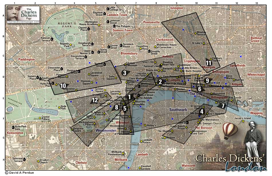
A Note on the Aerial Views
These splendid aerial views of London were drawn by Thomas Sulman (1834-1900) in the 1880s while soaring above the city in a balloon. The drawings were then engraved on woodblock by George William Ruffle (1838-1901) and W.M.R. Quick.
I have taken these images from a London guidebook by Herbert Fry (1830-1885) published in 1886. The images were printed in halves on facing pages and I have repaired the image centers which had fallen into the binding of the book. I have also cleaned up the text to make it more readable and applied a tint to the water to make the images clearer.
I have attempted to align the images with Dickens' lifetime, deleting some place names, and in some cases altering the illustration itself, to remove changes made after Dickens' death in 1870. For example, I have restored Temple Bar to its location between the Strand and Fleet Street and have removed the early construction of Tower Bridge from one of the images as it would have been unfamiliar to Dickens.
Also included with each view is a footprint of the area on Reynold's 1862 map of London.
David Perdue - The Charles Dickens Page - April 2020