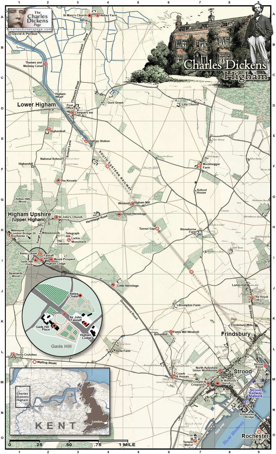
Charles Dickens' Higham
Explore the village in Kent where Charles Dickens spent his last years
Charles Dickens purchased Gads Hill Place, his "little Kentish freehold", in Upper Higham in 1856 and the hamlet was his principal residence for the last ten years of his life. Higham grew up around the medieval church and priory of St Mary's. In the 19th century development moved southward toward the London Road and a new parish church, St John's, was built in 1862 in what became known as Upper Higham, or Higham Upshire. The original village became known as Lower Higham.
Clickable map of Charles Dickens' Higham in Kent. Select a location (![]() ) to learn more about it and any Dickens associations.
) to learn more about it and any Dickens associations.
Abbey Farm
(map A-4)Remains of a priory attached to St Mary's Church. The nunnery was established in 1148 on land granted by King Stephen to his daughter, Mary, who became the first prioress. The nuns of the priory operated a profitable ferry business which transported travellers across the Thames to Essex. The priory was dissolved in the early 1500s, in advance of King Henry VIII's mid-century dissolution of the monasteries and priories, due to reasons of mismanagement and lewd behavior amongst the nuns. Indeed, several of the nuns were found to have been impregnated by the local vicar (Allen, 1965, p. 186-199). More history and photos...
Chequers Inn
(map D-3)18th-century inn which served Lower Higham during the boom with the coming of first the Thames and Medway Canal and later the railroad (Cook, 2020, p. 53). It was converted into flats in 2008 (Dover Kent Archives, Captured 20Nov2022). Image used with the kind permission of the Snodland Museum, Captured 20Nov2022.
Coach and Horses
(map M-6)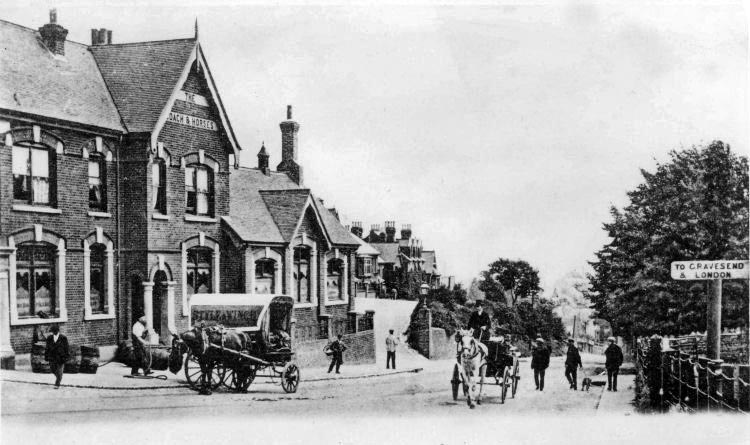
The Coach and Horses Public House 1904
Crispin and Crispianus
(map M-7)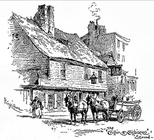
The Crispin and Crispianus Public House by FG Kitton
In his 1891 book A Week's Tramp in Dickens-Land, William R Hughes interviews the proprietor of the pub:
Mrs. Masters, the cheerful and obliging landlady, who has lived here thirty years, describes Dickens to us (as we sit in the seat he used now and then to occupy), when on one of his walks, as habited in low shoes not over-well mended, loose large check-patterned trousers that sometimes got entangled in the shoes when walking, a brown coat thrown open,sometimes without waistcoat, a belt instead of braces, a necktie which now and then got round towards his ear, and a large-brimmed felt hat, similar to an American's, set well at the back of his head. In his hand he carried by the middle an umbrella, which he was in the habit of constantly swinging, and if he had dogs (a not unfrequent occurrence), he had a small whip as well. He walked in the middle of the road at a rapid pace, upright, but with his eyes cast down as if in deep thought. When he called at the Crispin for refreshment,usually a glass of ale (mild sixpenny—bitter ale was not drawn in those days), or a little cold brandy and water, he walked straight in, and sat down at the corner of the settle on the right-hand side where the arm is, opposite the fire-place; he rarely spoke to any one, but looked round as though taking in everything at a glance (Hughes, 1891, p. 218-219).
Field's Mill
(map K-6)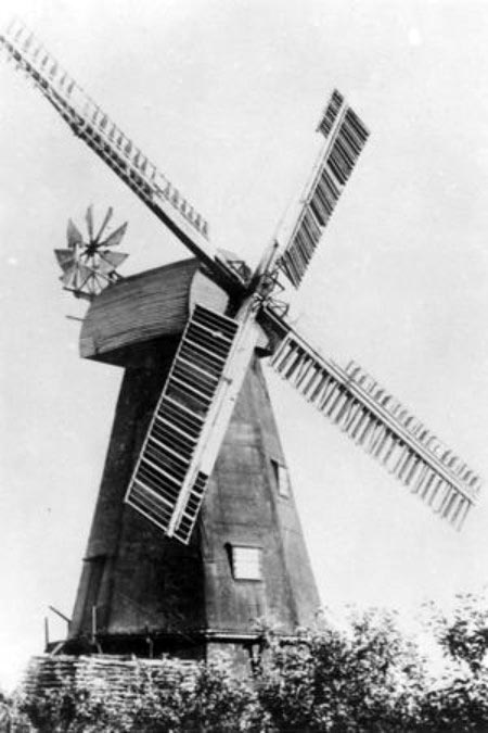
Field's Mill Windmill
Gads Hill Place
(map I-2)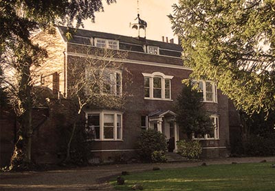
Gads Hill Place
Learn more about Gads Hill Place
Great Hermitage
(map H-4)The Great Hermitage was the ancestral home of the Head baronetcy (Wikipedia). Sir Frances Bond Head (1793-1875), 1st Baronet, who served as Lieutenant-Governor of Upper Canada from 1836 to 1838, owned the house during Dickens' time in Higham. Interestingly, Sir Francis was appointed as an assistant Poor Law Commissioner in Kent in 1834 and drafted a document called Plan of a Rural Workhouse for 500 Persons which called for some of the draconian measures featured in Dickens' Oliver Twist (Wikipedia). The Great Hermitage was used as a Voluntary Aid Detachment (VAD) hospital during WWI (British Red Cross, p. 41) and burned down in 1938 (Discover Gravesham, Captured 31Oct2022).
Highamhall
(map E-2)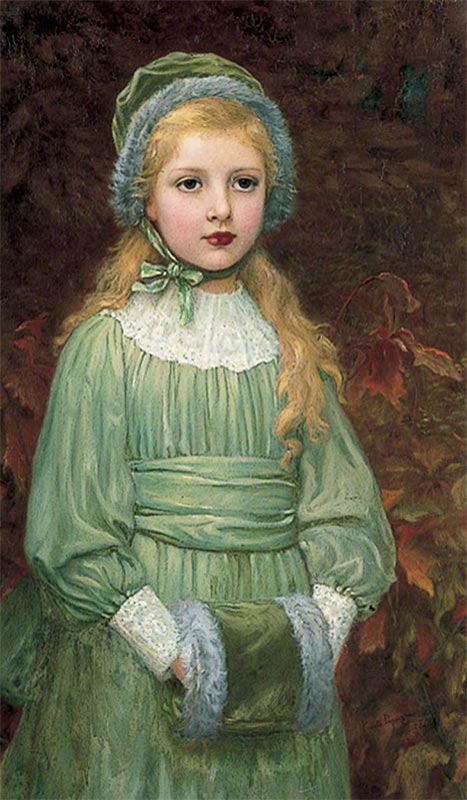
Dorothy de Michele by Kate Perugini 1892
Higham Mill
(map G-5)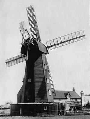
Higham Mill aka Rose's Mill
Higham Station
(map E-3)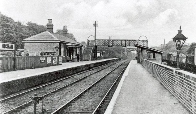
Higham Railway Station
Higham Tunnel
(map F-4)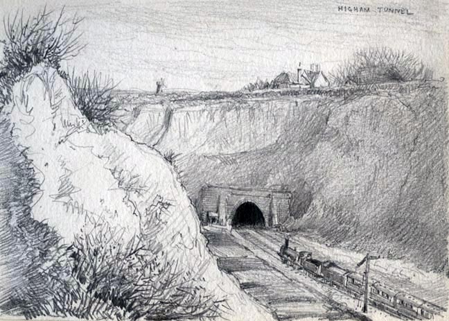
Higham Tunnel opening near Higham Station
The Knowle
(map F-2)Built as a vicarage by Rev Joseph Hindle and completed in 1857. Hindle was vicar of Higham for 45 years from 1829 to 1874. He was living at Gads Hill Place when Dickens bought it in 1856 and Dickens allowed him to remain there until the Knowle was completed a year later (Explore Kent - Charles Dickens and Higham, Captured 30Nov2022). Hindle was also responsible for the building of the new church of St John's in 1863 to replace the medieval church of St Marys (The Records of Rochester, 1910, p. 432). Today (2021) the Knowle operates as a wedding and event venue (Knowle Country House, Captured 30Nov2022).
Larkin Monument
(map H-3)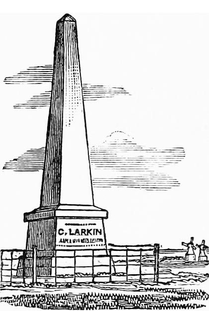
Larkin Monument
In 1860 a rumor was spread through Higham that the monument was haunted. Charles Dickens, living nearby at Gads Hill Place, decided to investigate. He describes the adventure in a letter to his friend, Wilkie Collins:
Rumours were brought into the house on Saturday night, that there was a "ghost" up at Larkins's monument. Plorn was frightened to death, and I was apprehensive of the ghost's spreading and coming there, and causing "warning" and desertion among the servants. Frank was at home, and Andrew Gordon was with us. Time, nine o'clock. Village talk and credulity, amazing. I armed the two boys with a short stick apiece, and shouldered my double-barrelled gun, well loaded with shot. "Now observe," says I to the domestics, "if anybody is playing tricks and has got a head, I'll blow it off." Immense impression. New groom evidently convinced that he has entered the service of a bloodthirsty demon. We ascend to the monument. Stop at the gate. Moon is rising. Heavy shadows. "Now, look out!" (from the bloodthirsty demon, in a loud, distinct voice). "If the ghost is here and I see him, so help me God I'll fire at him!" Suddenly, as we enter the field, a most extraordinary noise responds--terrific noise--human noise--and yet superhuman noise. B. T. D. brings piece to shoulder. "Did you hear that, pa?" says Frank. "I did," says I. Noise repeated--portentous, derisive, dull, dismal, damnable. We advance towards the sound. Something white comes lumbering through the darkness. An asthmatic sheep! Dead, as I judge, by this time. Leaving Frank to guard him, I took Andrew with me, and went all round the monument, and down into the ditch, and examined the field well, thinking it likely that somebody might be taking advantage of the sheep to frighten the village. Drama ends with discovery of no one, and triumphant return to rum-and-water (Hogarth et al, 1903, p. 507-508).
Little Hermitage
(map J-4)18th century mansion approximately three-quarters of a mile from Gads Hill Place. At the time of Dickens' residence at Gads Hill, Little Hermitage was owned by Mr James Hulkes. The Hulkes and the Dickens became close friends as well as neighbors (Forster, 1899, v. 2, p. 259n). Mr and Mrs Hulkes attended the wedding of Dickens' daughter, Kate, at St Mary's Church on July 17, 1860 (Forster, 1899, v. 2, p. 293) (Kaplan, 1988, p. 418-421).
Mr Hulkes, on being asked about Dickens in 1891, twenty years after the author's death, replied "I only knew his as a kind friend, a very genial host, and a most charming companion; to the poor he was always kind—a deserving beggar never went from his house unrelieved" (Hughes, 1891, p. 196).
In 1857 Dickens allowed Mrs Hulkes to read the conclusion of A Tale of Two Cities from the manuscript copy in advance of its being published. He did, however, swear her to secrecy (Hughes, 1891, p. 205).
Today (2021) Little Hermitage operates as a wedding and events venue (Little Hermitage, Captured 01Dec2022).
Milestone
(map H-1)Stone marker indicating that this location is 3 miles from Rochester and 26 miles from London Bridge. Peter Clark, in his book Dickens: London into Kent, reports that the Gravesend Road from Gravesend to Rochester was probably the busiest in Kent in the 18th and 19th century. It was also the second road in Kent to be managed by a turnpike trust, that is, a governing body empowered by Parliament to exact tolls to maintain the road. As such it featured milestones from the early 18th century. Indeed, the cloudy-minded Mrs F's Aunt in Little Dorrit blurts out "There's milestones on the Dover Road" (Clark, 2013, p. 158).
Mockbeggar Farm
(map F-7)The proprietor of Mockbeggar Farm, Mr Robert Lake Cobb, land agent and County Counsillor, was a frequest visitor to Gads Hill Place when Dickens lived there and remembered him as "a very pleasant neighbour, and had always got something nice to say. He was a dreadful man to walk—very few could keep up with him." Mr Cobb's son, Herbert, was a playfellow of Dickens' sons (Hughes, 1891, p. 374).
Mount Prospect
(map I-2)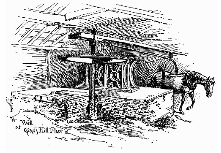
Well and Pump at Gads Hill Place
MY DEAR HENRY,
Here is a very serious business on the great estate respecting the water supply. Last night, they had pumped the well dry merely in raising the family supply for the day; and this morning (very little water having been got into the cisterns) it is dry again! It is pretty clear to me that we must look the thing in the face, and at once bore deeper, dig, or do some beastly thing or other, to secure this necessary in abundance. Meanwhile I am in a most plaintive and forlorn condition without your presence and counsel. I raise my voice in the wilderness and implore the same!!!
Wild legends are in circulation among the servants how that Captain Goldsmith on the knoll above--the skipper in that crow's-nest of a house--has millions of gallons of water always flowing for him. Can he have damaged my well? Can we imitate him, and have our millions of gallons? Goldsmith or I must fall, so I conceive.
If you get this, send me a telegraph message informing me when I may expect comfort. I am held by four of the family while I write this, in case I should do myself a mischief--it certainly won't be taking to drinking water.
Ever affectionately (most despairingly) (Hogarth et al, 1903, p. 430).
The problem was finally sorted when Dickens had a new well dug and soon had his own millions of gallons.
Dickens and Goldsmith also had a difference of opinion as to the location of the village mail box. When Dickens bought Gads Hill Place the mail box was located up the hill in front of Goldsmith's property. Dickens argued successfully that it would be more convenient on the Gravesend Road in front of his own house (Captain Edward Goldsmith and Charles Dickens' well pump, Captured 02Dec2022) (A Christmas Story: Captain Goldsmith, Charles Dickens, and the Higham mail box, Captured 05Dec2022).
North Aylesford Union Workhouse
(map M-8)The first workhouse in Strood dates from 1721 and was replaced in 1837 by the North Aylesford Union Workhouse (The Workhouse - The Story of an Institution, Captured 02Dec2022).
Rochester
(map O-9)For information on Rochester and Chatham see my Charles Dickens' Rochester/Chatham Map.
Royal Oak Beer House
(map J-9)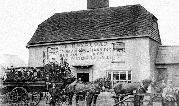
The Royal Oak Beer House in 1900
St John's Church
(map H-2)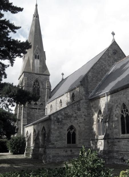
St John's Church
St Mary's Church
(map A-3)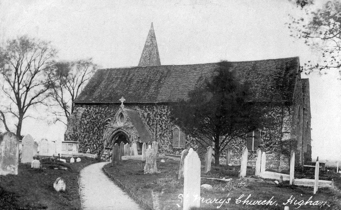
St Mary's Church
Charles Dickens' daughter Kate married Charles Collins at St Mary's on July 17, 1860 (Kaplan, 1988, p. 418). Hans Christian Anderson attended services here with the Dickens family during his extended 1857 visit (Watts, 1989, p. 67).
Although the original for Pip's village and the churchyard from Great Expectations is generally considered to be based on St James' Church near the Cooling marshes, two and a half miles to the east, W. Laurence Gadd, is his article The Topography of Great Expectations from the July 1, 1924 issue of The Dickensian, makes a compelling argument that St Mary's, and the village of Lower Higham, served as Dickens' model (The Dickensian, 1924, p. 131).
St Nicholas's Church
(map M-8)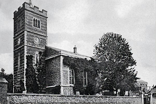
St Nicholas's Church 1889
Sir John Falstaff
(map I-2)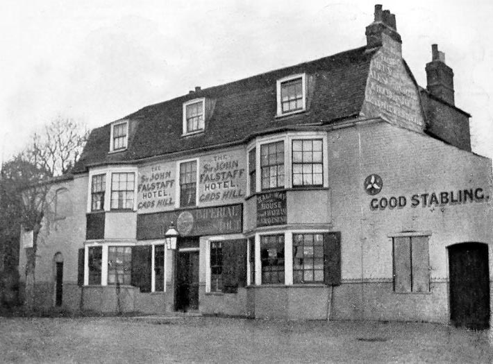
Sir John Falstaff
In Dickens' The Uncommercial Traveller he described the inn as "A little hostelry which no man possessed of a penny was ever known to pass in warm weather" (The Uncommercial Traveller, p. 115)
Strood Basin
(map L-9)The Strood canal basin, long orphaned by the closing of the Thames and Medway Canal, was back-filled in 1986 and has now been built over (Wikipedia).
Strood Railway Stations
(map M-9)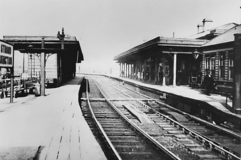
Strood Station (2) 1910
2 - This station, still in operation today (2021), was built in 1856 when the line exiting the Strood tunnel was linked to the existing Maidstone branch. Two years later, in 1858, the line was extended across the Medway to Chatham (Wikipedia).
3 - Rochester Bridge Railway Station, built by the East Kent Railway, opened in 1860 and closed in 1917. It was finally demolished in the late 1960s (Wikipedia).
The interesting story of the Higham and Strood Tunnel, and its conversion to railway use into Strood (Kent Rail, Captured 05Dec2022).
Strood Tunnel
(map I-7)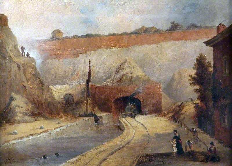
Train exiting Strood Tunnel. Photo credit: Ironbridge Gorge Museum Trust.
Swiss Châlet
(map I-2)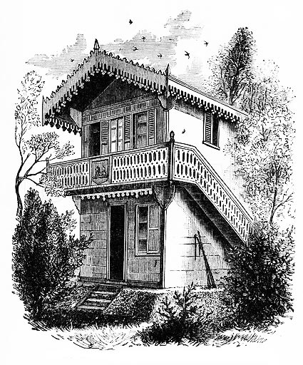
Swiss Châlet
During the summer months Dickens used the châlet to write. In a letter to a friend he described this treetop study: "I have put five mirrors in the châlet where I write, and they reflect and refract, in all kinds of ways, the leaves that are quivering at the windows, and the great fields of waving corn, and the sail-dotted river. My room is up among the branches of the trees; and the birds and the butterflies fly in and out, and the green branches shoot in at the open windows, and the lights and shadows of the clouds come and go with the rest of the company. The scent of the flowers, and indeed of everything that is growing for miles and miles, is most delicious" (Forster, 1899, v. 2, p. 262-264).
Temple Manor
(map O-7)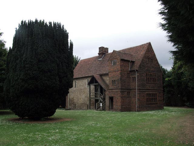
Temple Manor, Strood - Photo: Chris Whippet
Thames and Medway Canal
(map C-2)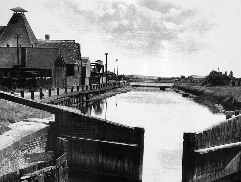
Thames and Medway Canal near Gravesend 1960s
With the coming of the railway in the 1830 traffic decreased on the canal and in 1844 the new Gravesend and Rochester Railway (G&R) ran a single track through the tunnel using the canal's towpath and struts sunk into the canal as support. Both Higham and Strood were provided with railway stations, the line ended in Strood.
In 1846 the South Eastern Railway (SER) acquired the line, closed it temporarily, and drained the canal. They then laid a double track through the tunnel and connected the line to Maidstone. Higham station received a second platform and the Strood station was moved and became a through junction.
The canal between Gravesend and Higham remained in use until 1934 and suffered bomb damage during World War II. In recent years parts of the canal have been restored for recreational use (Wikipedia) (Kent Rail, Captured 30Nov2022).
The Three Crutches
(map L-1)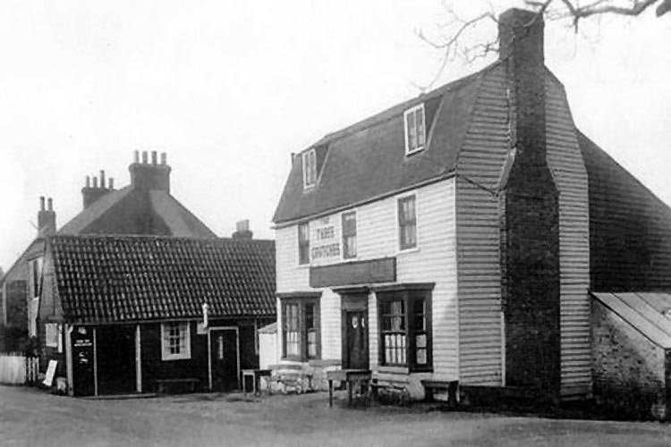
The Three Crutches in 1930
Tunnel Gap
(map H-6)200-foot gap between the Higham and Strood Tunnels originally built to allow barges to pass one another when the tunnel was used by the Thames and Medway Canal (Wikipedia).
Watling Street
(map L-2)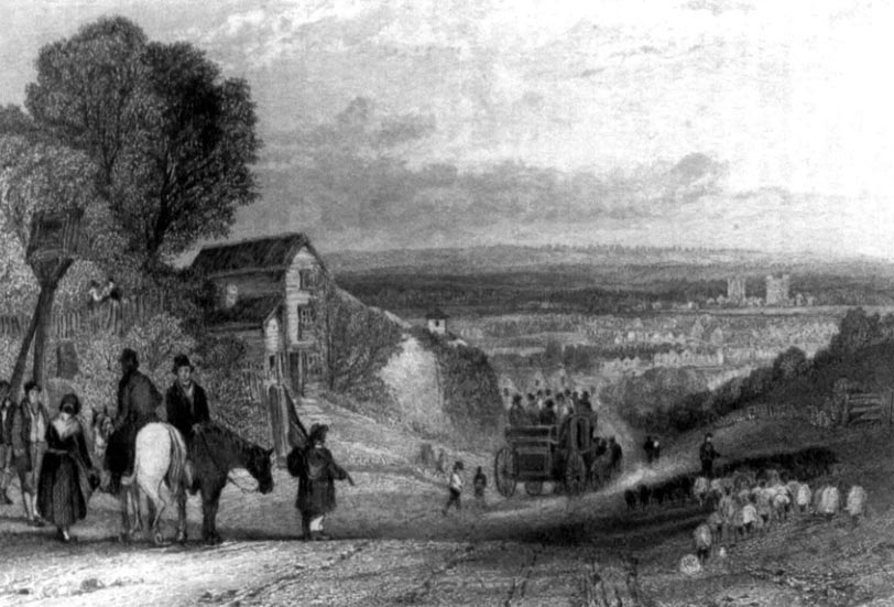
Watling Street. The approach to Rochester in the 19th century.